Once upon a time and probably in the future once again Greece had a lot more lakes. I have posted about the Lake at Lerna before.
This is admittedly a VERY simplified map showing Lake Copais after Mycenaean hydro-engineering diverted rivers into canals. However it should work on smaller screens. I will show you some more precise maps in the next post.
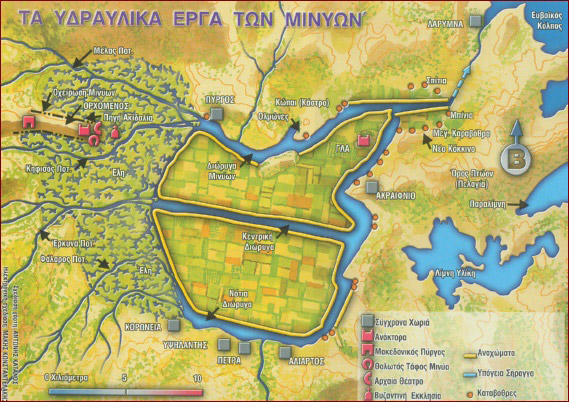
The important things to note are the wetlands to the west of the Copaic basin and the settlements ringing the lake especially GLA.
The canals lead to sinkholes which hercules is should to be blocked so the Orchomenian cavalry could not stop the advance of Theban forces.
The wetlands and part of the lands drained by the canals were probably used for pasturing horses and cattle as well as growing crops.
Judging from various maps I have seen the lake has changed in shape and size several times as earthquakes or human effort blocked or unblocked sinkholes or created drainage tunnels and canals.
The last major project in the 19th century drained the lake completely so its all farmland FOR NOW.
Stay tuned for the next posts in this series !
No comments:
Post a Comment