#lakecopais #ancientgreece #map
Here's a third interpretation of the available data about the Mycenaean canalization of Lake Copais.
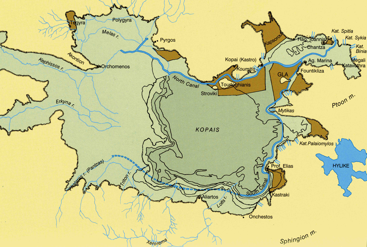
Where it says kat. are indications of the places where the lake drains into underground rivers and sinkholes. Well the ones we know about. Strabo writes 9.2.16 of earthquakes blocking some and opening others over the centuries and there may have been an underground river flowing from the NE and rising from the ground to flow a short distance into the sea near Larymna, again according to Strabo.
The goal of the Minyan engineers from Orchomenus may possibly also have been not just to divert flood waters away from their city but to also make it easier to cross the wetlands when the waters was low by using the canals and paths along them as roads or for barges perhaps? Plus silt building up behind the facings of the canals might have increased the available areas for not just grazing cattle and horses but also growing crops.
Bu the ancient works were destroyed allegedly by Heracles during a dispute between Orchomenus and Thebes and the waters and shorelines changed again and yet again and according to Strabo 9.2.17 several settlements had to change their location and move away from the lakes ever shifting shorelines.
This leads us to the mystery of GLA.
Next time
Just which one of the polises mentioned in Homer's Catalogue of ships was GLA?
No comments:
Post a Comment