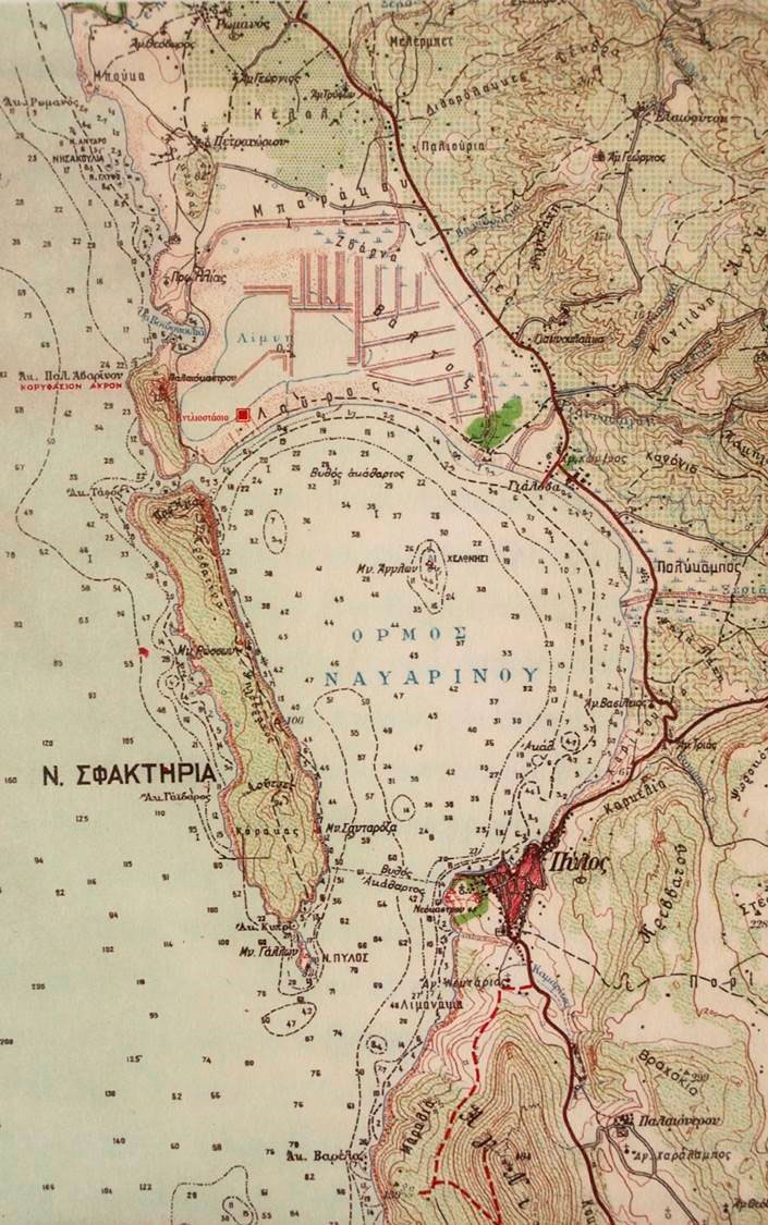
There's clearly been considerable silting in the northern end of the bay since ancient times and you can see the small semi circular shaped cove that was the port for mycenaean homeric and classical Pylos ... and the tiny narrow shallow channel between Sphacteria and the peninsula ancient Pylos was on before people moved down to the modern location.
Now Nestor is said to have had a large fleet and certainly the combatants during the 19th c battle of Navarino had no trouble manuvering in the southern part of the bay but were did Nestor keep his fleet?
Is it possible the Sphacteria channel was deep enough in the Mycenaean period for ships to get through using beacons and a high tide if they had a shallow draught?
Land uplift maybe at the north end of the bay?
Any geologist reading this?
I know there's a major fault line along the western side of the bay creating cliffs of the eastern side of the island.
Could there be more structures buried under the sand dunes?
Could silting combined with shorelines changes be why Messenia and Pylos ceased to be a major SEA power even before the Spartan conquest?
No comments:
Post a Comment